Flood Information for Horsham, Quantong and Natimuk
Published on 26 October 2022
MODERATE FLOODING PEAKED AT HORSHAM WEDNESDAY MORNING
Moderate flooding is occurring along the Wimmera River Glenorchy to Horsham, with a moderate flood peak downstream of Horsham. Minor flooding is continuing along the Wimmera River at Quantong Bridge.
Further rainfall is forecast in the coming days, which may lead to renewed river level rises. The situation is being closely monitored, and warnings will be updated as necessary.
Flood warnings and river heights are available via the BOM website.
HORSHAM INFORMATION
People in the area between a 20-year and 50-year flood should be alert to potential impacts.
Horsham 50-year flood map
Horsham 20-year flood map
QUANTONG INFORMATION
Moderate flooding is occurring along the Wimmera River downstream of Horsham.
No houses are expected to be impacted directly by floodwater. However some properties in the Quantong area may be isolated for 2-3 days:
- Hateley Road
- Struthers Avenue
- Blocks Road
ROAD CLOSURES
Because of the severe weather conditions, signs may not have been placed on all roads that are too dangerous to use.
Road Being Closed today.
- Northern Grampians Tourist Rd/Mt Victory Road
Roads Closed
- Downies Lane has been closed from Jallumba-Mockinya rd to Red Rock Rd
- Longerong Road –Drung Jung Intersection, through to Murtoa - Glenorcy Rd
- Petrie Lane, Horsham
- Rocklands-Cherrypool Rd
- Ellis Road (West Wail Road to Hinnebergs Road)
- Mervyn Road (West Wail Road to Hinnebergs Road)
- Old Wartook Road (Green Lake Road to Laharum Road)
Roads Re-opened
- Byrnes Rd
- O’Biernes Rd
- Heards Rd
- Walters Road (West Wail Road to Hinnebergs Road)
- Horsham Lubeck Rd
- Horsham Wal Wal Rd
- Peppertree Lane…..Trinity Drive to Pryors Rd.
- Rokeskys Rd at Horsham-Lubeck rd.
- Riverside East Rd at Horsham-Lubeck Rd
- Riverside Rd at Dooen rd.
- Drung Jung Road
- North East Wonwondah Road (between Henty Highway and Laharum Road)
- Brimpaen Laharum Rd (Northern Grampians Rd to Henty Hwy)
- Rifle Butts Rd
- Lanes Road (Wonwondah/Toolondo Road to Rifle Butts Road)
- Wondwondah-Toolondo Rd
- Plush Hannans Road
- Clear Lake-Sherwoods Dam Rd
- Horsham-Noradjuha Rd (Three Bridges Rd to Noradjuha)
- Northern Grampians Rd (south of Wartook)
WASTE SERVICES
Closed Roads
- There will be no waste collections on closed roads
- Leave your bin out if it is safe to do so
- Collection will occur as soon as possible once the road is reopened
- Keep an eye for the list of road closures above.
Roads impacted with water
- Collections will continue but may be delayed as trucks are travelling at lower speeds to avoid wash impacts on homes
- Be patient, leave your bin out
- Call customer service 53829777 if it is more than two days and your bin hasn’t been collected.
Rural waste collection
- If your road is impassable, take your waste bin to the nearest bitumen intersection
- All bins at these points will be collected.
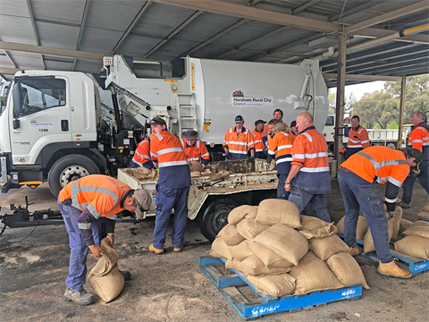
SANDBAGS FOR RESIDENTS
Council, SES and other agencies have made extensive preparations for affected properties, including supply of sandbags, and door knocking for those properties to alert them to the situation.
Council will continue to make sandbags available where there is a need, however, it is assessed that the properties most likely to be impacted have already had these offered or supplied.
People impacted by the floods can contact Council for advice about any relief or recovery requirements.
PREPARING FOR EMERGENCY
The Wimmera 72 website has information and resources to help residents prepare for having food, water and other supplies to last for at least 72 hours.
Wimmera 72 Emergency Brochure(PDF, 1MB)